
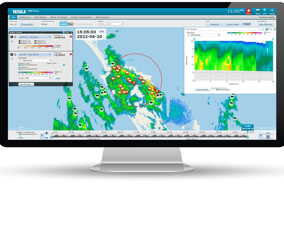
IRIS Focus overview
IRIS Focus provides user-friendly, browser-based tools for viewing and analyzing weather data received from weather radars, WindCube Scan Lidars, and lightning sensors. Weather data is overlaid on a geographical map.
IRIS Focus forms the visualization and on-demand product generation front-end, while other software components handle device control, some product generation, and data distribution.
Weather radar data in the pictures of this chapter: courtesy of Meteorological Service of New Zealand Ltd. Lightning data: courtesy of Transpower New Zealand Ltd.

With the zoomable and draggable animation timeline, you can easily visualize recent, past, or nowcasted data.
Significant weather events such as thunderstorms, wind shear, or heavy rain are automatically detected and trigger alerts when they enter an area of interest.
The currently displayed weather product is automatically updated to the latest one available.
Nowcasting performs advection calculations on motion data from weather products to predict weather movement and severity in the near future (by default, for the next 2 hours).
Radar data
Radar data is gathered from a single weather radar or a network of radar sites through a composite. When viewing weather radar data, the map is centered on a selected radar site or composite site.
Lidar data
Windcube Scan Lidar data can be ingested to IRIS Focus in NetCDF format. IRIS Focus supports viewing lidar data from PPI and Fixed scans. Available on-demand products are currently PPI, RTI, and Turbulence. In addition, pre-generated products SHEAR, WARN, WIND are also available.
Lightning data
Lightning data is visualized through products such as TimeSpan, which provides information about recent lightning events on a customizable map.
With the zoomable animation timeline, you can easily visualize and animate recent data.

Weather products
The displayed data typically consists of radar, lidar, or lightning products.
Radar products are raw signal data from a radar receiver processed to provide information about current weather conditions. They provide information such as radar signal reflectivity or rain intensity for analysis by meteorologists.
Wind lidar products are either raw data measured by the sensor itself, like Doppler velocity, CNR (carrier-to-noise ratio), SNR (lidar reflectivity), pregenerated products from IRIS Analysis (WIND, SHEAR), or processed on-demand products in IRIS Focus (PPI, RTI, Turbulence). Lidar data enables precise measurements of wind fields, aerosol, and cloud layers in the atmosphere to give detailed observations about the lowest part of the atmosphere, that is, the boundary layer.
Lightning products visualize data from a lightning sensor network, produced by the Total Lightning Processor (TLP) software. Lightning products visualize, for example, the type and amplitude of lightning events.